

 Sign-In
 Cart
Cart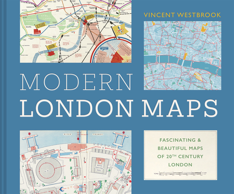
The Maps That Made Modern London: Fascinating and Beautiful Maps from the London Metropolitan Archives
Hardcover
Publisher Price: $49.95
ISBN13: 9781849949392
Publisher: Batsford
Published: May 13 2025
Pages: 160
Weight: 1.25
Language: English
One of the best ways to gain an insight into a city's multi-layered past is by deciphering its maps, and this curated collection of over 100 historical maps of London will help you do just that. Many of these hugely interesting and significant maps are also beautiful works of art in themselves.
The majority of the maps in this collection have been drawn from the historical treasure house that is the London Metropolitan Archives, which has been housing London's records since 1889. The maps are presented in thematic chapters, including:
- Making Connections: Maps of the railways, tube system and roads
- Out with the Old and In with the New: London's numerous upgrades
- For Richer for Poorer: A city of extremes
- Let's Go Outside: London's green spaces and the River Thames
- Picture This: Pictorial, decorative and artistic maps.
Also in
Atlases
The World Atlas of Coffee: From Beans to Brewing -- Coffees Explored, Explained and Enjoyed
Hoffmann, James
Hardcover
Ultimate Bible Atlas: Hundreds of Full-Color Photos, Maps, Charts, and Reconstructions of the Bible Lands
Csb Bibles by Holman
Hardcover
National Geographic Concise Atlas of the World, 5th Edition: Authoritative and Complete, with More Than 200 Maps and Illustrations
National Geographic
Paperback
Photographic Atlas of the Moon: A Comprehensive Guide for the Amateur Astronomer
Reeves, Robert
Hardcover
National Geographic Stargazer's Atlas: The Ultimate Guide to the Night Sky
Wei-Haas, Maya
National Geographic
Trefil, James
Hardcover
Maps of the Ancient Sea Kings: Evidence of Advanced Civilization in the Ice Age
Hapgood, Charles
Paperback
Atlas of the Invisible: Maps and Graphics That Will Change How You See the World
Uberti, Oliver
Cheshire, James
Hardcover
North American Maps for Curious Minds: 100 New Ways to See the Continent
Bucklan, Matthew
Cizek, Victor
Hardcover
Observer's Sky Atlas: The 500 Best Deep-Sky Objects with Charts and Images
Karkoschka, Erich
Hardcover
Pocket Atlas of Remote Islands: Fifty Islands I Have Not Visited and Never Will
Schalansky, Judith
Hardcover
Atlas of Improbable Places: A Journey to the World's Most Unusual Corners
Elborough, Travis
Paperback
Here Today: Oklahoma's Ghost Towns, Vanishing Towns, and Towns Persisting Against the Odds
Schmidt, Jeffrey B.
Paperback
National Geographic Visual Atlas of the World, 2nd Edition: Fully Revised and Updated
National Geographic
Hardcover
The Maps of Gettysburg: An Atlas of the Gettysburg Campaign, June 3 - July 13, 1863
Gottfried, Bradley M.
Hardcover
Bon Voyage Travel Notebook: A Journal For Those Who Love To Travel The World
Purtill, Sharon
Paperback
Hell by the Acre: A Narrative History of the Stones River Campaign, November 1862-January 1863
Masters, Daniel A.
Hardcover
Cáw Pawá Láakni / They Are Not Forgotten: Sahaptian Place Names Atlas of the Cayuse, Umatilla, and Walla Walla
Cash Cash, Phillip E.
Hunn, Eugene S.
Morning Owl, E. Thomas
Paperback
Atlas of World War II: History's Greatest Conflict Revealed Through Rare Wartime Maps and New Cartography
Hyslop, Stephen G.
Hardcover
World Atlas of Beer: The Essential Guide to the Beers of the World
Webb, Tim
Beaumont, Stephen
Hardcover
New York State Birds: A Folding Pocket Guide to Familiar Species
Kavanagh, James
Waterford Press
Other
The Map Thief: The Gripping Story of an Esteemed Rare-Map Dealer Who Made Millions Stealing Priceless Maps
Blanding, Michael
Paperback
The History of a Periphery: Spanish Colonial Cartography from Colombia's Pacific Lowlands
Wiersema, Juliet B.
Hardcover
A Grand Opening Squandered: The Battle for Petersburg: June 15-18, 1864
Chick, Sean Michael
Paperback
Upper Left Cities: A Cultural Atlas of San Francisco, Portland, and Seattle
Shobe, Hunter
Banis, David
Hardcover
"Strong Men of the Regiment Sobbed Like Children": John Reynolds' I Corps at Gettysburg on July 1, 1863
Priest, John Michael
Hardcover
Wish You Were Here: Guidebooks, Viewbooks, Photobooks, and Maps of New York City 1807-1940
Tomasko, Mark D.
Paperback
The Historical Atlas of New York City: A Visual Celebration of 400 Years of New York City's History
Homberger, Eric
Paperback