

 Sign-In
 Cart
Cart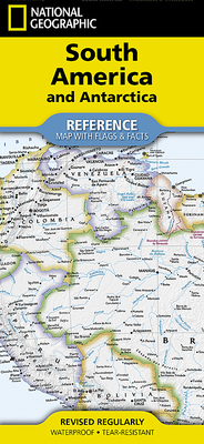
National Geographic South America and Antarctica Map (Folded with Flags and Facts)
Other
Series: National Geographic Reference Map
Currently unavailable to order
Please enter your email and a message will be sent to you when this product becomes available on our website.
ISBN13: 9781566959346
Publisher: National Geographic Maps
Pages: 2
Weight: 0.20
Height: 0.20 Width: 4.20 Depth: 9.40
Language: English
Expertly researched and designed, National Geographic's South America and Antarctica Flags & Facts Map is the authoritative map of South America by which other reference maps are measured. The map side includeds a political map showing countries, cities and other landmarks and a physical map shows the landforms such as mountain ranges and rivers. The Flags & Facts side includes a combined political and physical map of Antarctica.
- Clearly defined boundaries, major cities, and physical features
- Hundreds of place names carefully placed to maintain legibility in heavily populated areas
- Includes South America and Antarctica and adjacent regions within North America
- Detailed physical map of South America with mountain ranges, plains, lakes, and rivers
- Flags and facts with detailed information about cultural and physcial attributes
- Printed in the U.S.A. on extremely durable, waterproof, and tear-resistant material
This Reference Map is printed on durable synthetic paper, making it waterproof, tear-resistant and tough -- capable of withstanding the rigors of any kind of use in the home or classroom.
- Sheet Size = 18.5 x 25.25
- Folded Size = 4.25 x 9.25
Also in
Atlases
The World Atlas of Coffee: From Beans to Brewing -- Coffees Explored, Explained and Enjoyed
Hoffmann, James
Hardcover
Ultimate Bible Atlas: Hundreds of Full-Color Photos, Maps, Charts, and Reconstructions of the Bible Lands
Csb Bibles by Holman
Hardcover
National Geographic Concise Atlas of the World, 5th Edition: Authoritative and Complete, with More Than 200 Maps and Illustrations
National Geographic
Paperback
Photographic Atlas of the Moon: A Comprehensive Guide for the Amateur Astronomer
Reeves, Robert
Hardcover
National Geographic Stargazer's Atlas: The Ultimate Guide to the Night Sky
Wei-Haas, Maya
National Geographic
Trefil, James
Hardcover
Maps of the Ancient Sea Kings: Evidence of Advanced Civilization in the Ice Age
Hapgood, Charles
Paperback
Atlas of the Invisible: Maps and Graphics That Will Change How You See the World
Cheshire, James
Uberti, Oliver
Hardcover
North American Maps for Curious Minds: 100 New Ways to See the Continent
Cizek, Victor
Bucklan, Matthew
Hardcover
Observer's Sky Atlas: The 500 Best Deep-Sky Objects with Charts and Images
Karkoschka, Erich
Hardcover
Pocket Atlas of Remote Islands: Fifty Islands I Have Not Visited and Never Will
Schalansky, Judith
Hardcover
Here Today: Oklahoma's Ghost Towns, Vanishing Towns, and Towns Persisting Against the Odds
Schmidt, Jeffrey B.
Paperback
Atlas of Improbable Places: A Journey to the World's Most Unusual Corners
Elborough, Travis
Paperback
National Geographic Visual Atlas of the World, 2nd Edition: Fully Revised and Updated
National Geographic
Hardcover
The Maps of Gettysburg: An Atlas of the Gettysburg Campaign, June 3 - July 13, 1863
Gottfried, Bradley M.
Hardcover
Bon Voyage Travel Notebook: A Journal For Those Who Love To Travel The World
Purtill, Sharon
Paperback
Hell by the Acre: A Narrative History of the Stones River Campaign, November 1862-January 1863
Masters, Daniel A.
Hardcover
Cáw Pawá Láakni / They Are Not Forgotten: Sahaptian Place Names Atlas of the Cayuse, Umatilla, and Walla Walla
Cash Cash, Phillip E.
Hunn, Eugene S.
Morning Owl, E. Thomas
Paperback
World Atlas of Beer: The Essential Guide to the Beers of the World
Webb, Tim
Beaumont, Stephen
Hardcover
The Map Thief: The Gripping Story of an Esteemed Rare-Map Dealer Who Made Millions Stealing Priceless Maps
Blanding, Michael
Paperback
New York State Birds: A Folding Pocket Guide to Familiar Species
Kavanagh, James
Waterford Press
Other
Atlas of World War II: History's Greatest Conflict Revealed Through Rare Wartime Maps and New Cartography
Hyslop, Stephen G.
Hardcover
The History of a Periphery: Spanish Colonial Cartography from Colombia's Pacific Lowlands
Wiersema, Juliet B.
Hardcover
A Grand Opening Squandered: The Battle for Petersburg: June 15-18, 1864
Chick, Sean Michael
Paperback
Upper Left Cities: A Cultural Atlas of San Francisco, Portland, and Seattle
Shobe, Hunter
Banis, David
Hardcover
"Strong Men of the Regiment Sobbed Like Children": John Reynolds' I Corps at Gettysburg on July 1, 1863
Priest, John Michael
Hardcover
The Historical Atlas of New York City: A Visual Celebration of 400 Years of New York City's History
Homberger, Eric
Paperback
Countries of the World in Minutes: Histories, Key Data, and Maps for All 195 Countries
Field, Jacob F.
Paperback
The Blood-Tinted Waters of the Shenandoah: The 1864 Valley Campaign's Battle of Cool Spring, July 17-18, 1864
Noyalas, Jonathan A.
Paperback